By Tom Schweich
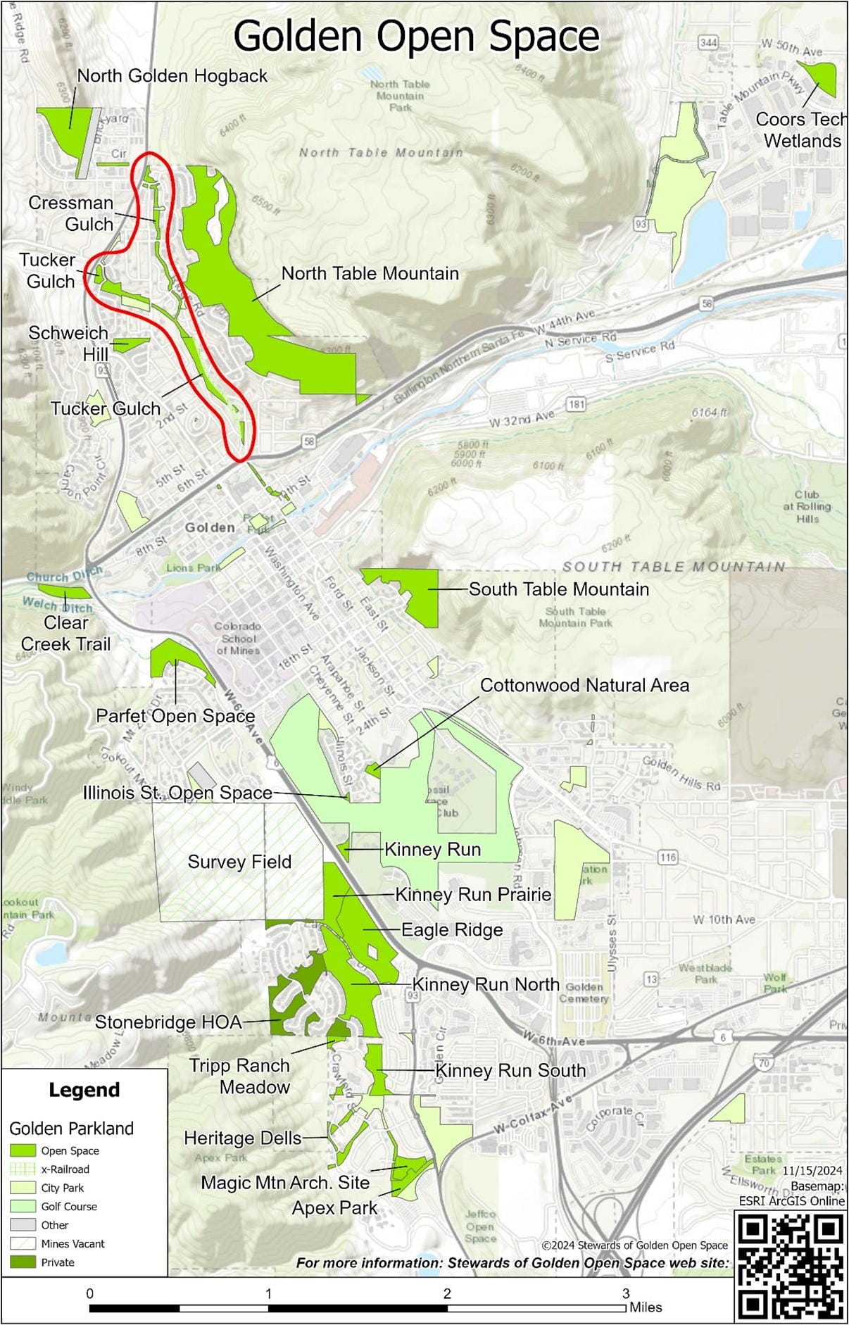
This is the fourth installment in a series about the City of Golden’s Open Spaces while the city staff, citizens, and consultants work on our first Open Space Master Plan. (See: PDF Map of Golden’s Open Space.) The first three were North Golden Hogback, North Table Mountain, and Schweich Hill. Today’s potential open spaces, Tucker Gulch and Cressman Gulch, are a little different. They are narrow, linear spaces with important Public Works functions that may not actually qualify as “Open Space.”

Tucker Gulch is named after Alfred Tucker who moved with his wife to Golden in 1859 from Illinois. It originally included a toll road and a railroad, but now it is reduced to a long narrow linear space between Golden neighborhoods. The city-owned portion of Tucker Gulch from Clear Creek up to Colorado Highway 93 is about a mile and a quarter in length, while the width varies from 50 to 275 feet. The total area is about 21 acres in 18 to 29 separate parcels of land, depending on how one counts.
Tucker Gulch has an important Public Works function as a flood channel draining Golden Gate Canyon and, to a lesser extent, Cressman Gulch. It has been the scene of eighteen recorded floods between August 1, 1869, and most recently May 7, 1973 (Anonymous, n.d.; White and Chapman, 2014). Tucker Gulch is also a convenient place for utilities serving adjacent neighborhoods, such as water and sewer lines, and it contains both, though they are well disguised.
Cressman Gulch is about 5.9 acres in size and made up of 8 parcels of land that are typically 50 to 75 feet in width. Primarily used for flood control, utilities, and drainage, there is also a city-owned concrete trail along part of Cressman Gulch.
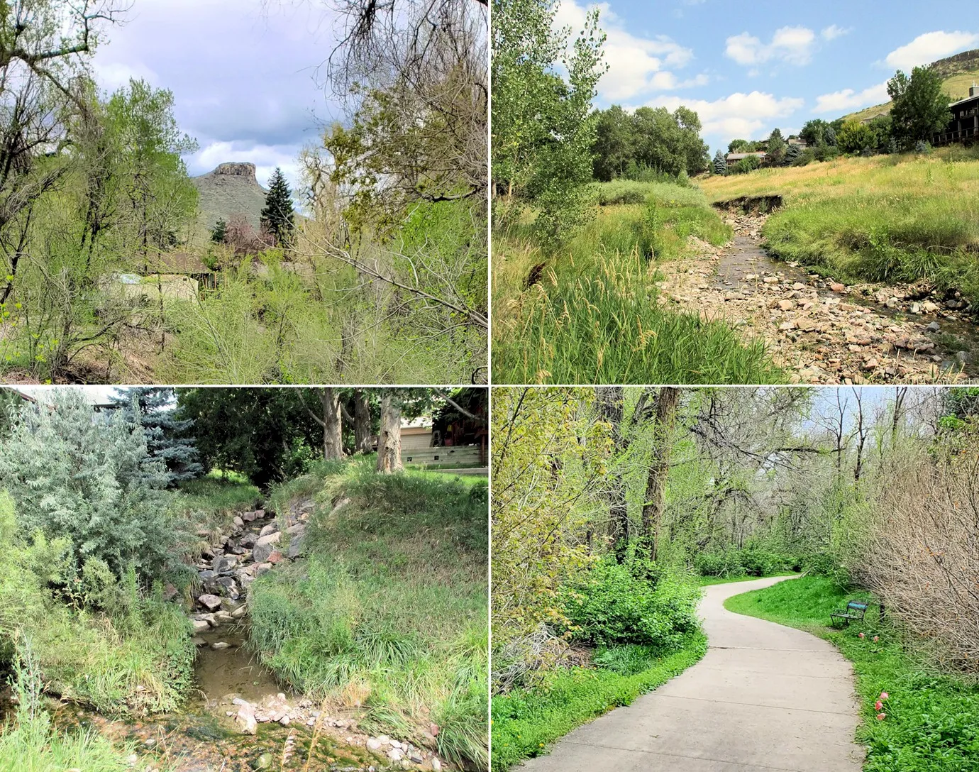
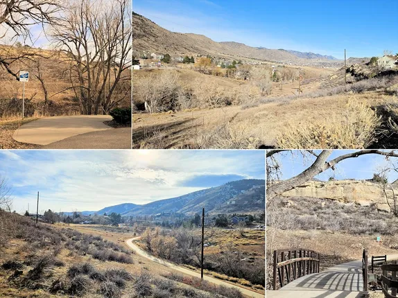
Tucker Gulch, especially, also has some attractive recreational values. The Tucker Gulch Trail winds alongside a perennial stream aligned with groves of established trees, shrubs and grasses. There are numerous access points: 7th Street, 1st Street, North Ford Street (at Norman D. Park) and Mesa Drive. There is little traffic noise providing trail users with a peaceful nature experience. The wider parts of Tucker Gulch have places for peace and solitude. Birds and wildlife are common in Tucker Gulch. Bears, moose and, sometimes, mountain lions are reported in Tucker Gulch on social media. On a recent morning, a friend and I saw an 8-point buck just north of 1st Street, and a pair of flickers feeding on the ground beside the trail.
Like a lot of places in Golden, Tucker Gulch and Cressman Gulch have their problems with weeds, yard waste disposal, and social trails, which do not negate the recreational value of the gulches.
At North Ford Street, the Tucker Gulch Trail passes through Norman D. Park where there is water and a restroom (OK … a Port-A-Potty). As it happens, the city’s land also includes a strip on the north side of the creek that is 50 to 100 feet wide. This strip was originally planned for a street connecting Golden Gate Drive to Mesa Drive. Since this connecting street has never been constructed, perhaps it could be added to the open space in Tucker Gulch.
Neither Tucker Gulch nor Cressman Gulch are typical plots of land that one thinks of as “open space.” Neither are they parks. But they both have significant recreational values in addition to Public Works purposes. It seems to me that our Open Space Master Plan needs to acknowledge these linear open spaces and define how our Public Works and Parks & Recreation departments jointly manage them for our present and future enjoyment. What do you think? Please tell the city on the Path to Play page of Guiding Golden.
References
Anonymous. n.d. Golden, Colorado Flood History: Tucker Gulch & Kenneys Run (Excerpts from 1983 Flood Hazard Area Delineation report). Mile High Flood District. Date retrieved: November 15, 2024. https://www.udfcd.org/FWP/floodhistory/golden.html Includes a link to a printer-friendly version at the bottom of the page.
White, Sally L., and Margaret Chapman, editors. 2014. Floods of Jefferson County, et seq. Historically Jeffco. Issue 35. Jefferson County Historical Commission. Date retrieved: November 15, 2024. https://historicjeffco.wordpress.com/wp-content/uploads/2015/02/2014histjeffco35.pdf


