By Tom Schweich
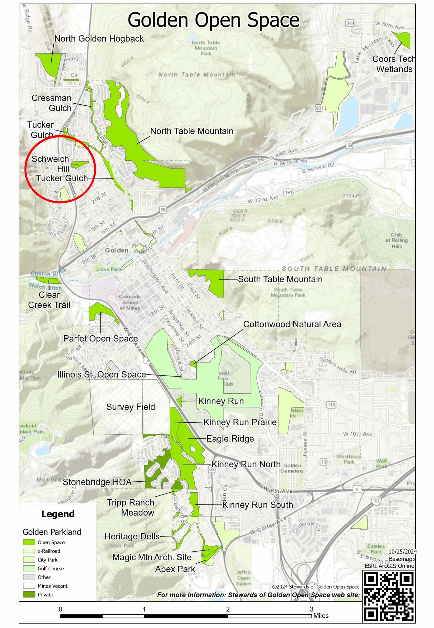
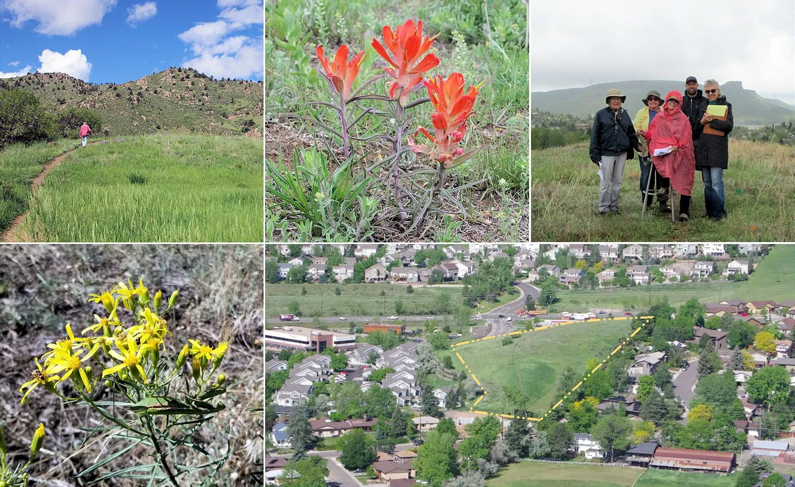
The City of Golden is working on our first Open Space Master Plan to define how we care for the approximately 400 acres of open space in our city (See: PDF Map of Golden Open Space). One of our smallest open spaces is Schweich Hill, just 4 acres in size at the north end of Washington Avenue. In the photo above-right, Schweich Hill extends from Cannonball Creek Brewery in the west to N. Ford Street in the east.
Schweich Hill was deeded to the city in 1993 for open space, utilities, and drainage, as part of Canyon Point Filing No. 4 that created the space for Altitude Apartments. Neighborhood housing borders the land as well as a small commercial district. The name Schweich Hill was adopted by the city in 2021. The hill has been left fallow, except for weeding by volunteers and spraying of noxious weeds.

There are four ways to access Schweich Hill. The easiest is at the entrance to the Conoco Station and 7-Eleven that is across Washington Avenue from Starbucks. There is a city sign here that identifies the site as Schweich Hill. The other main entrance is on N. Ford Street just south of Alaska Street where N. Ford curves. Look for an unsigned gravel path. Schweich hill can also be entered from the alley between N. Ford and N. Columbine Streets, and by way of a social trail runs behind (north) of Cannonball Creek Brewery and Evolution Fitness.
There are several social trails on Schweich Hill. The primary social trail runs over the top of the hill from N. Ford Street to Cannonball Creek Brewery. A second trail runs along the south edge of the open space and provides access from Altitude Apartments to the 7-Eleven. While these social trails provide community access, they also erode easily and migrate sideways because of muddy or difficult walking conditions (Schweich, 2024).
Much of the open space is disturbed by construction, disposal of excess soil, social trails, yard waste disposal by neighbors, miscellaneous digging. and pet bunny interment. Some of the disturbed portion is overrun by smooth brome (Bromus inermis Leyss.), a valuable non-native agricultural grass that is very invasive of Colorado native prairies.
Nevertheless, approximately 1.5 acres on the top of the hill have both short and tall native grasses, which together with the native forbs (perennial plants that are not woody), show that the top of the hill is a nearly intact remnant of mixed-grass prairie. Ninety-three species of native Colorado plants have been documented on Schweich Hill, in addition to 45 species of non-native plants, mostly weeds (Schweich, 2024).
The geology is mapped as upturned Arapahoe and Laramie Formations (68-75 million years), but the surface is covered by thin layer of colluvium (sand and pebbles). The Golden Fault Zone passes to the west, between Colorado Highway 93 and Mesa View Drive (Anderson and Haseman. 2021).
Wildlife is seldom seen on Schweich Hill because it is close to civilization and the noise of Colorado Highway 93. However, this space supports typical small mammal wildlife such as meadow voles, bunnies, and even deer occasionally, plus birds and, importantly, it is a good haven for pollinators.
The expansive scenic views from the top of this open space are to the north and south foothills as well as North and South Table Mountains and to central Golden.
References
Anderson, Donna S. and Paul B. Haseman. 2021. Golden Rocks: The Geology and Mining History of Golden, Colorado, Golden, Colorado. https://repository.mines.edu/handle/11124/14162
Colorado Natural Heritage Program. 2021. Biological Survey of Golden Open Space Property. Warner College of Natural Resources, Colorado State University. https://cnhp.colostate.edu/download/documents/2021/CNHP-Golden-Open-Space-Survey-final-report.pdf
Schweich, Tom. 2024. Botanical Resources of Schweich Hill, Golden, Jefferson County, Colorado. https://www.schweich.com/PDF/Botanical_Resources_Schweich_Hill.pdf
Stewards of Golden Open Space. 2019-2024. Schweich Hill. https://stewardsofgolden.org/schweich-hill


