
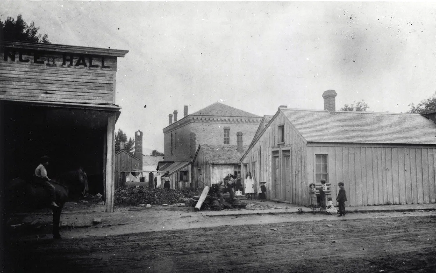
This photo comes from Dan Abbot’s collection. I believe that's Burgess House in the background, so this was apparently taken from 10th Street. I like the “NCE HALL” (presumably DANCE HALL) on the left side of the picture.
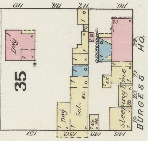
These buildings appear on the 1886 Sanborn Insurance Map. The NCE HALL appears on that map as a saloon (SAL). Both the sleeping rooms and the saloon are still there in the 1896 insurance map, but by the 1900 map, the saloon is marked “vacant.” In the 1906 map, some of the sleeping rooms are gone and the saloon has become a carpenter’s workshop. In the 1911 and 1919 maps the sleeping rooms are there but the saloon/carpenter’s shop is vacant again, and by 1935 the saloon building is gone. The “Dwg” (Dwelling) on the left side of the map is a constant in the 1886 through 1935 maps.
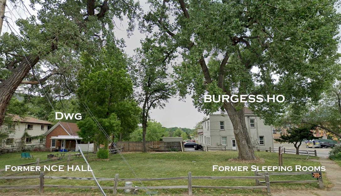
The Burgess House and the little house next door are still there today, but the sleeping rooms are gone.
