COVID Updates
COVID Vaccine Appointments
State of Colorado: Where You Can Get Vaccinated
Jeffco Public Health Vaccine Call Center: 303-239-7000
State Vaccine Hotline: 1-877-268-2926.
Golden Testing Sites
Mines COVID Testing | Jeffco Fairgrounds COVID Testing
More Public Health References
Sign up for exposure notifications | CDC | Colorado | Jefferson County | City of Golden
Virtual Events
Online Worship:
Calvary Episcopal Church | Faith Lutheran Church | First United Methodist Church | Flatirons Community Church | Golden Church of Christ | Golden Presbyterian Church | Hillside Community Church | Jefferson Unitarian Church | Rockland Community Church | St. Joseph Catholic Church
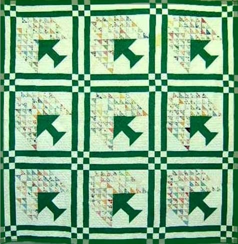
2PM Sunday at the Museum – 1930’s Depression Quilts
Real World Events
10AM Wild West Walking Tour
11AM-2PM Brunch at the Rose
4PM Colorado Super League Final
The final game between Harpos FC and Guadalajara will be held at the Denver Kickers Clubhouse on Sunday, June 13 at 4 p.m. The Colorado Super League is the state’s only recognized United States Adult Soccer Association (USASA) State Premier League, consisting of the best amateur teams in the state.
LIVE MUSIC:
11AM Scott Slay @ Buffalo Rose (Sky Bar Stage – outdoor patio)
2PM Shawn Eckels at Golden Mill
2PM Mortise & Tenon @ Over Yonder
3PM Funk It Up at Wrigley’s
8PM Karaoke Contest at Ace Hi Tavern
Golden History Moment:
Golden’s Open Space and the Clay-Mining Connection
by Donna Anderson
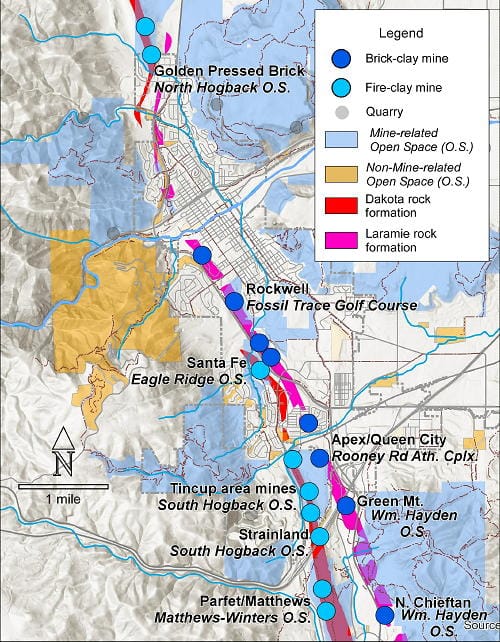
Over 90% of the open space and parks in and around Golden has its roots in mining. That figure might astonish you. The color-coded map shows open spaces and parks (in light blue) that have some connection to the mining history of Golden. Clay mines from the Dakota and Laramie rock formations are shown in dark blue. Aggregate quarries are shown in in gray, to be discussed in a later article.
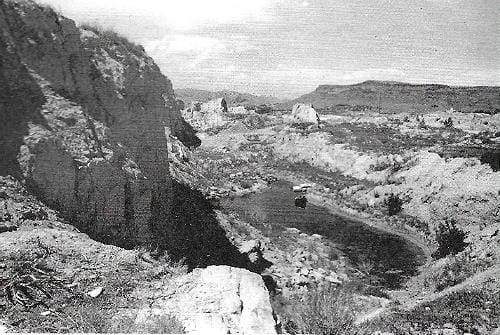
If you are a golfer, you might say, “Oh, yes, of course. The back-nine on Fossil Trace Golf Course used to be a clay mine, right?” Yes, and you can still see the old workings of the former Rockwell Mine along Triceratops Trail on the west side of the Golf Course. Or, if you have played soccer at the Rooney Road Athletic Complex, you might have a vague notion that the fields lie atop a reclaimed Jeffco garbage dump, operated from 1958 to 1980. The dump (or more politely called a landfill) filled in the former the Apex/Queen City clay mine that operated from the 1880s to about 1955. Both it and the Fossil Trace Golf Course are on former clay mines along the super clay-rich Laramie rock formation, and all of which were operated by the Parfet family (See A Ton of Bricks January 2021). But these two places are the tip of the iceberg in terms of the clay-mine and open-space connection.
Green Mountain, now the William Hayden Open Space Park owned by the City of Lakewood, has clay-mining roots, too. The far-west side of the mountain, next to today’s C-470, has been and still is, the site of clay mining in the Laramie Formation. If you have wondered about the new dirt piles on the northeast side of the intersection of Alameda Parkway and C-470, they mark the location of the North Chieftan Mine that has operated for decades. The former Green Mountain Mine near the C-470 to I-70 interchange has been reclaimed by re-grading to restore the land surface contours, as is now required by State and Federal laws.
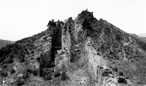
Much of the earliest clay mining in Golden was along the Dakota Hogbacks (see A Lump of Fire-Clay December 2020) in the Dakota rock formation. Within the city limits, all these areas are now open space, but with limited to no public access due to mine hazards. When fire-clay mining was active, from about 1867 to 1955, no laws required that the mineworks be reclaimed. So, open shafts and trenches that have 100+ foot drops exist along the tops of the Hogbacks. Let’s just say that today the Hogbacks contain attractive nuisances and are great places to find rattlesnakes, who don’t care about clay but love the rocky outcrops.
Clay-mining related open space, then, constitutes nearly 30% of open space and park lands in and around Golden. Next up: the aggregate connection.
Guest Columnist Donna Anderson is an Affiliate Faculty Member in Geology at Mines. She and Paul Haseman are writing a book called “Golden Rocks!” about the geology and mining history of Golden.
Citations:
Lee, W.T., 1927, Correlation of geologic formations between east-central Colorado, central Wyoming, and southern Montana: USGS Professional Paper 149, Plate 32A.
Amuedo & Ivey, 1978, Coal and clay mine hazard study and estimated unmined coal resources, Jefferson County, Colorado, prepared for the County of Jefferson and the cities of Arvada, Golden and Lakewood, CO, Figure 28.
Thanks to Kim Soulliere for use of City of Golden GIS data.

